Egan’s Corner Site Plan
A site plan is a vital part of any construction project. Many municipalities require one to apply for a permit. While you can definitely have a site plan drawn up by an architect or engineer, you can also make one yourself.
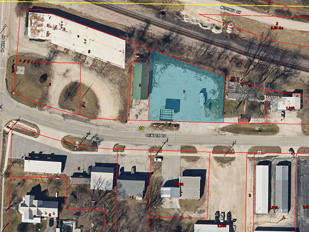
I’m starting with a bird’s eye view from my counties GIS map. This can help visualize easements and other important things, including finding out that all the times the city called to remind us to cut the grass out front of this property, they actually owned it the whole time.
Now, I’m going to zoom in and create a cleaner site plan with some measurements on it. Some things to keep in mind are to mark any utility poles, in this case there is one on the east side of the property that we can’t build within 20 feet of, but there is also the opportunity to move it.
Depending on where you live, you may need to mark any trees, including species, over a certain size. Since it seems like all of the larger trees are on land owned by the railroad, my initial siteplan is quite simple.
I do think we may need to look further into getting the pole moved, although we are limited because there is a home directly to the east that is quite near the property line. I am also working on another project for the west side of the property so visually I would like to model them up in Sketchup and see what this looks like in 3D.
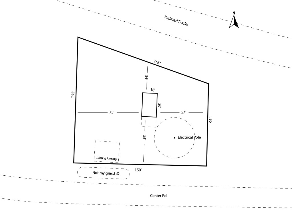
When I hear back on the status of the pole, I’ll update and add to this site plan!